
Understanding Our Rivers: Transformation in Chicago’s River Corridors
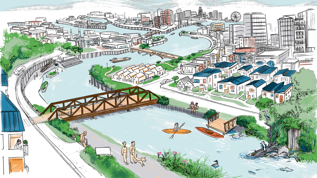
The Our Great Rivers initiative was a catalyst for change in our rivers and riverfronts.
Chicago’s rivers touch more than 25 communities and are vital natural, economic, and social assets. The rivers can – and do – benefit our neighborhoods and the city we call home. Collective action, comprehensive planning, and investment have addressed many longstanding challenges to our rivers. As new challenges emerge, decision-makers must learn from past efforts and seize the opportunity to strengthen the rivers and communities that we visit, enjoy, depend on, and call home.
Our Great Rivers reshaped the approach to planning on – and around – Chicago’s rivers. Launched in 2016, it was a pivotal time when the riverwalk was expanding, significant water quality improvements had been achieved, and interest in visioning for the river corridor was stronger than ever.
Our Great Rivers established an updated vision for riverfront investments, building from previous plans, that resulted in renewed focus on investing in riverfront projects, collaborations, and other initiatives – including the recommendation to establish the City of Chicago’s River Ecology and Governance Task Force.
This research project, Understanding Our Rivers: Transformation in Chicago’s River Corridors, reveals some of the changes since that time, with the goal of documenting progress and showcasing the potential for innovative investment, collaborative action, and strategic thinking about river corridors for the future.
We are at another exciting time for river corridors in Chicago, and now is the time to reflect on this progress and strategically decide what’s next. Although Chicago has made great strides in advancing the principles of this vision, we still have work today. River improvements are not distributed evenly across the city, with some stretches continuing to face pollution, flooding, erosion, and inadequate access to the recreational and economic benefits the river can provide.
For more than 100 years, the history of Chicago’s 150-plus miles of river and riverfront was of pollution and neglect, but since the Clean Water Act of 1972, the 1979 founding of the Friends of the Chicago River, and the varied investments and programs centered on improving Chicago’s river corridors, the river system is now viewed in a different light. Due to the commitments made to repair the harm the river corridors are now cleaner and more accessible – supporting the resiliency, local economic growth, and physical and mental health of surrounding communities.
The creation of Our Great Rivers was a milestone in thinking about the river comprehensively. Released in 2016 by the City of Chicago, MPC, and other partners, it is a unifying vision to create a river system that is inviting, productive, and living, meeting the needs of residents, communities, businesses, and ecology alike. It was created to spark change in how Chicagoans view the three rivers within the city’s borders: the Chicago, Calumet, and Des Plaines Rivers.
Today, as the river corridors continue to transform, proactive city efforts to strategically – and boldly – plan for investments is urgently needed. It is an ideal moment to update the strategic vision for the river corridor so it can simultaneously protect communities from the effects of climate change, create access to nature for all residents, allow nature in the city to thrive, and support economic growth both on and around the rivers.
MPC developed this evaluation to provide information on how the river system has changed since the Our Great Rivers initiative was launched. The evaluation documents trends in demographics, socio-economic, and community development, to share how the overall river system, as well as community areas along the river, have transformed over the last decade. To be consistent with Our Great Rivers, we grouped the quantitative data into categories to correspond with the themes of inviting, productive, and living. With the help of partners, we combined this data with community stories about their evolving relationships with the river. In doing so, MPC hopes to create a more complete picture of why investment in our rivers and riverfronts is critical for our region, and why our approach must be thoughtful and keep equity in mind, so that all of the more than 25 community areas that the rivers touch benefit from its transformation into the future.
Our Rivers: Inviting, Productive, and Living
This evaluation explores data as part of three themes: Inviting, Productive, and Living. These three themes were developed as part of the Our Great Rivers initiative and were used to provide a way to group the goals and action steps of the vision.
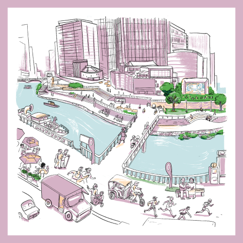
Inviting Rivers
Infrastructure, information, and programming that make our rivers more intuitive, meaningful, and exciting places to be, drawing people to recreate, work, and relax. Data points include land use, trails, access points, community projects, and activations.
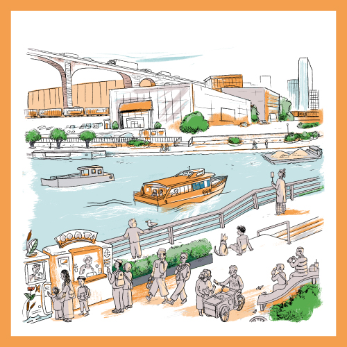
Productive Rivers
Working rivers that are transportation arteries, commercial corridors and tourism generators. Data points include jobs, businesses, and vacancy.
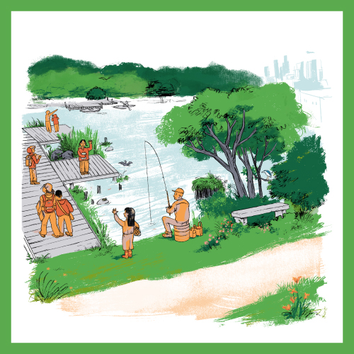
Living Rivers
From riverbeds to shorelines, plants, animals, and people will co-exist in vibrant and healthy ecosystems. Data points include fish diversity, open space, and combined sewer overflow events.
The River Reaches
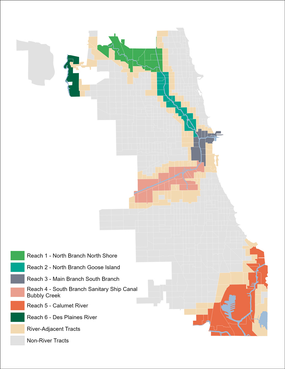
Our river system is expansive and diverse. Out of approximately 605,500 citywide parcels of land across the city, more than one-in-ten (12%) directly touch the river system. When considering the parcels that touch those parcels (which we call river adjacent parcels), as well as the river parcels, it’s closer to one-third (31%) of all parcels. That’s a lot of land! To understand the general diversity, differences, and similarities between river parcels, river adjacent parcels, and non-river-adjacent parcels, our team generated data that fell into those three categories. To compare the geographies across the city, we broke this project down into a single city-wide data set and six sections of the river system, which we call reaches. The specific reaches we researched and collected stories about are:
- Reach 1: North Branch / North Shore
- Reach 2: North Branch / Goose Island
- Reach 3: Main Branch / Downtown / South Branch
- Reach 4: South Branch / Bubbly Creek
- Reach 5: The Calumet River
- Reach 6: The Des Plaines River
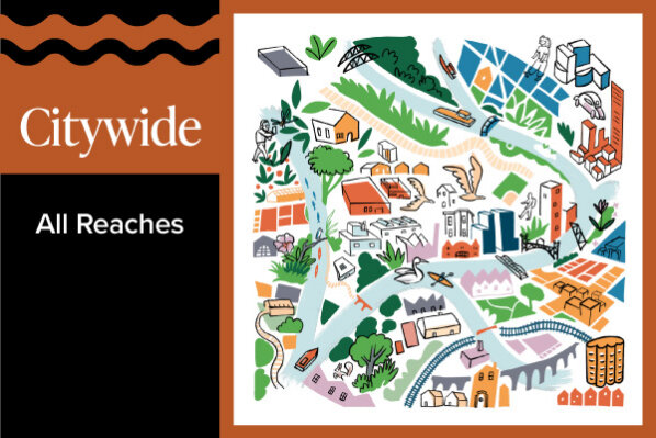
All Reaches
The Chicago River system includes the North Branch, Main Branch, South Branch, Calumet River, and Des Planes River. Together, these waterways make up over 150 miles, making the river a defining feature of the city’s landscape and an incredibly powerful asset for many communities. As a vital economic engine, destination for recreation, and habitat for fish, birds, and other wildlife, the river system can (and often does!) support thriving neighborhoods, connected communities, and environmental and economic well-being for the region.
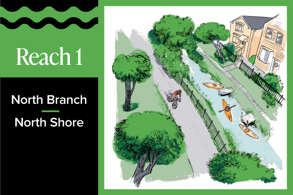
Reach 1: North Branch / North Shore
The North Shore / North Branch of the Chicago River is a reach that extends for 10.5 miles and touches seven community areas including: Lincoln Square, Albany Park, North Park, West Ridge, Forest Glen, Norwood Park, and Jefferson Park. It is a dynamic and diverse reach that meanders through several Chicago Parks including LeBaugh Woods, Legion, and River Park.
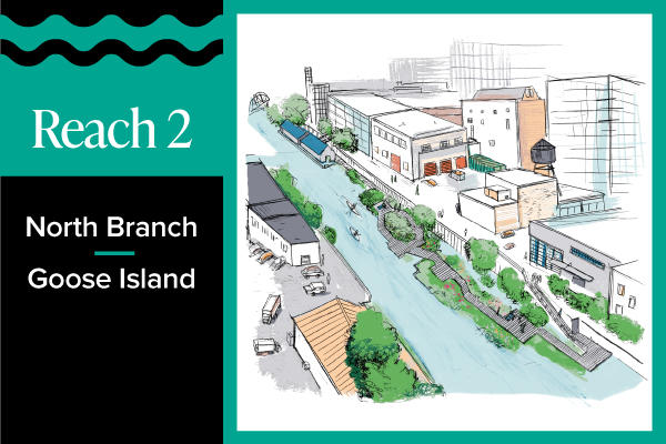
Reach 2: North Branch / Goose Island
The North Branch / Goose Island Branch includes the North Branch of the Chicago River, Goose Island, and North Branch Canal. Bounded by Ontario Street to the south and Gunnison to the north, the overall length is 4.5 miles and it crosses through the industrial areas and redevelopment, specifically around Goose Island. It touches the community areas of Lincoln Square, Albany Park, North Center, Irving Park, Avondale, Lincoln Park, Logan Square, West Town, and Near North Side.
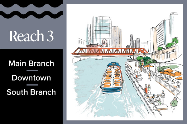
Reach 3: Main Branch / Downtown / South Branch
This reach includes the Main Branch of the Chicago Rive and parts of the South Branch of the Chicago River. Bounded by W 20th Place to the south, Ontario Street to the north, and Lake Michigan to the east, the overall length is 3.5 miles and it includes the downtown Riverwalk area along with Chinatown’s Ping Tom Park. It touches the community areas of West Town, Near North Side, the Loop, Near West Side, Near South Side, Lower West Side, and Armour Square.
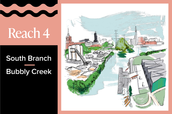
Reach 4: South Branch / Bubbly Creek
This reach includes the South Branch of the Chicago River, the Sanitary Ship Canal, and Bubbly Creek. Bounded by S Cicero Avenue to the southwest and W 20th Place to the north, the overall length is 6.5 miles and it includes very active industrial uses alongside new residential developments. It touches the community areas of Armour Square, Bridgeport, Lower West Side, McKinley Park, Brighton Park, Archer Heights, South Lawndale, and Garfield Ridge.
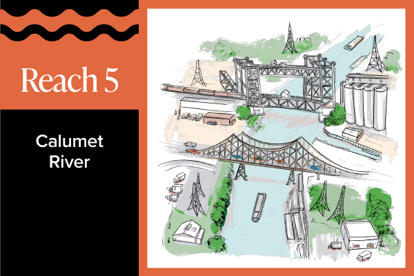
Reach 5: The Calumet River
This reach includes the Calumet River, Lake Calumet, and Little Calumet River. Bound by Morgan Street to the west and Lake Michigan on the east, and setting the border of the City of Chicago with Riverdale. The overall length is 13 miles and it is home to the Illinois International Port District as well as many other industrial uses. It touches the community areas of West Pullman, Riverdale, South Deering, Hegewisch, East Side, Calumet Heights, and South Chicago.
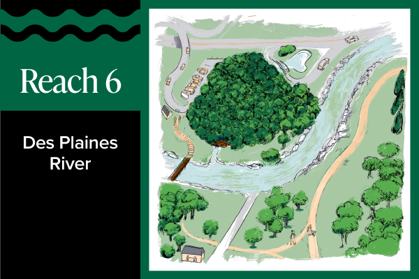
Reach 6: The Des Plaines River
This reach includes the Des Plaines River. Bounded by W. Belmont Avenue on the south and Higgins Road on the north, setting the border of the City of Chicago with Franklin Park. The overall length is 4.3 miles with significant amounts of river edge located in Forest Preserve of Cook County land, like Schiller Woods. It touches the O’Hare community area.
Methodology
Research Approach
This project examined how areas (census tracts) along the river changed over time, from approximately 2015 to 2025. Data related to demographic, socioeconomic, development, and ecological changes, were compiled to understand how areas along the river transformed over the decade. Trends/variables included:
- Population changes by racial and ethnic group
- Rent and home value changes
- Job, business, and vacancy rate changes
- Land uses
- Trails and access points
- Community projects and activations
- Fish diversity
In addition to breaking down the river geography at the citywide and “reach”-level scale, we examined data by census tracts based on their proximity to the river:
- River tracts: Census tracts that touch a river in the city of Chicago
- River adjacent tracts: Tracts that touch the “river tracts.” Data in these tracts act as a proxy to the nearby neighborhood in order to differentiate general neighborhood trends from findings that are unique to tracts that directly abut the river.
Research Questions
For each data area, we asked the following questions, which allow for a nuanced look at how river areas have developed, when compared to other parts of the city:
- How do trends/changes compare across specific river areas (aka “reaches”)?
- How do trends/changes along the river (aka “river tracts”) compare to changes in areas immediately adjacent to river census tracts (aka “river adjacent tracts”, which are the comparison groups)?
- How do trends/changes along the river compare to changes across the city as a whole (all city census tracts)?
Sources
All sources for this research are listed on the Data Set Factsheets available on each reach page.
Acknowledgements
MPC thanks The Chicago Community Trust for funding the Our Great Rivers projects, including this evaluation. MPC also acknowledges the leadership and commitment of Friends of the Chicago River and The River Ecology and Governance Task Force. Without their support, our rivers would not be as inviting, productive, or living.
MPC also thanks the community partners who lead transformative projects along their riverfronts, especially those who participated in the ‘In the Current’ interviews for each reach:
- Reach 1: Lauren Umek, PhD, Urban Ecologist and Project Manager, Chicago Park District
- Reach 2: Phil Nicodemus, Research Director, Urban Rivers
- Reach 3: Josh Coles, Museum Director of McCormick Bridgehouse & Chicago River Museum, Friends of the Chicago River
- Reach 3 & 4: Grace Chan McKibben, Executive Director, Coalition for a Better Chinese American Community (CBCAC)
- Reach 4: Kate Eakin, Executive Director, McKinley Park Development Council (MPDC)
- Reach 4: Eladio Montenegro, Director of Projects and Programs, McKinley Park Development Council (MPDC)
- Reach 5: Yessenia Balcazar, Senior Resilient Community Planning Manager, Southeast Environmental Task Force (SETF)
- Reach 5: Adella Bass-Lawson, Health Equity Organizer, People for Community Recovery (PCR)
- Reach 5: Maggie Catania, Co-Executive Director, Calumet Collaborative
- Reach 5: Jamira Johnson, Executive Director, Riverdale Community Land Trust (RCLT)
- Reach 5: Jack Paul Rocha, Senior Planner, Chicago Metropolitan Agency for Planning (CMAP)
- Reach 6: Justin Mercer, Program Coordinator of Central/Southwest Region, Department of Conservation & Experiential Programming at Forest Preserve District of Cook County
- Reach 6: Iza Redlinski, Deputy Director of Resource Management, Forest Preserve District of Cook County
- Reach 6: Pam Sielski, Landscape Architect, Forest Preserve District of Cook County
- Reach 6: John Watson, PE, CFM, NGICP, Senior Civil Engineer of Water Resources, Forest Preserve District of Cook County
- Reach 6: Daniel White, Chief of Landscape Architecture & Planning, Department of Planning and Development of Forest Preserve District of Cook County
Learn about more of the Our Great Rivers projects and visualize the Chicago River System by exploring the StoryMap. The illustrations for this project were done by Chicago-based artist Lucie Van der Elst.
This evaluation project was produced by the MPC staff listed below. It was also developed and supported by Christina Harris, Alec Singer, and Kate Mackie, with graphic design and web support by Carolyn Schiffner.


