Our Great Rivers: three projects that are transforming land use in the Calumet Region

By: Rachel Gaunce
May 1, 2024 / Blogs
May 1, 2024 / Blogs
This is the fourth blog in our four-part series where we highlight the projects that are included as part of this cycle’s Our Great Rivers grant program. Stay tuned for future updates about all these projects.
Since 2018, the Metropolitan Planning Council has been highlighting the progress of riverfront projects funded through The Chicago Community Trust’s support for the Our Great Rivers vision. To date, 25 projects have been supported by The Trust, and are continuing to make impactful changes throughout the river system. Learn more about these projects in MPC’s interactive story map.
Our Great Rivers 2023-2024 Cohort Spotlight
The Calumet region on the Southeast side of Chicago, home to the Calumet River and the Little Calumet River, has a long history of industrial use and a rich legacy of labor and community organizing. Five of the Our Great Rivers grantee projects in this grant cycle support communities in taking the lead to transforming the region into one with vibrant economic opportunities with thriving community and natural spaces that promote wealth building and public health. This blog about Calumet area projects features projects focused on three integrated projects that are working with partners to change area land uses, while the other blog features two projects that focus on community development.
Community Vision for the Future Calumet Industrial Corridor: Calumet Connect
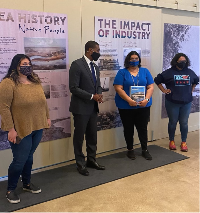
Advocates from Natural Resources Defense Council, Little Village Environmental Justice Organization, and Southeast Environmental Task Force hand US EPA administrator the Calumet Connect Databook.
Photo courtesy of The Alliance for the Great Lakes
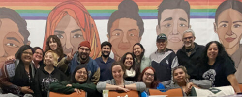
Stop General Iron Campaign Meeting
Photo Courtesy of Southeast Environmental Taskforce
The Calumet Connect is a local coalition of community and civic stakeholders focused on improving the health and well-being of communities and residents in Southeast Chicago by shaping the future of the Calumet region based on community vision. Funded by The Trust’s Our Great Rivers grant, the partnership conducted community engagement and research to create the Calumet Connect Databook, highlighting the environmental and public health challenges in the Calumet Industrial Corridor. This initiative (along with years of organizing efforts by many other community groups and activists) helped inform the HUD investigation that found “the city of Chicago is violating the civil rights of its residents by relocating polluting businesses from white communities into Black and Latino areas that already are overwhelmed with environmental and health issues.” The agreement settled from the investigation requires the City of Chicago to take actionable steps to protect neighborhoods in the Calumet region that have been burdened by environmental harm and led to the creation of City’s Environmental Justice Action Plans.
To build on the momentum fueled by the HUD ruling, SETF and partners are continuing community engagement to expand the stakeholders involved in Calumet Connect, including residents, businesses, and other community organizations. The goal is to build on existing community organizing efforts to ensure community members lead the charge for change in the region.
The Calumet Connect partnership is a part of three Our Great Rivers Cohort projects this year, including the update to the Calumet Design Guidelines and Calumet Area Land Use Plan, Schroud site remediation, and 100th Street site activation. Southeast Environmental Task Force intentionally brought these project partners together to ensure tight coordination of the community engagement needed to ensure resident voices are centered in each of these efforts
Calumet Design Guidelines and Calumet Area Land Use Plan
In 2016, the City of Chicago started an Industrial Corridor Modernization Process, acknowledging that land use and zoning designations in industrial corridors needed an update. Years of community advocacy and the recent HUD investigation laid the groundwork for Chicago’s Department of Planning and Development (DPD) to review the Calumet Industrial Corridor, with a focus on ensuring the process centers community and resident voices. The planning process will include updating the Calumet Design Guidelines and Calumet Area Land Use Plan. These policy documents are more than 20 years old. Updates will include revisions to land use and zoning along with additional requirements and guidelines for future development in the area. The goal is to shape the industrial corridor in alignment with community, economic, and environmental needs.
The Alliance for the Great Lakes, UIC’s Great Cities Institute, The Southeast Environmental Task Force (SETF), Calumet Collaborative, Friends of the Chicago River, Metropolitan Planning Council (MPC), and Calumet Connect partners are supporting community engagement efforts to ensure community leaders are driving the plan development. These efforts include conducting an industry survey to better understand industry needs (and their relationship to community needs), increase resident understanding of how land use and zoning impact their communities, and organizing stakeholders so that they are ready to fully engage in DPD’s process, which will take place over a three-year period.
Schroud Site Remediation
Map of the Schroud Site. Source: EPA
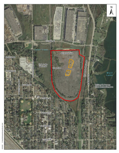
The Schroud site was formerly Republic Steel’s dump site, leaving behind waste (a lot of slag, but also other more volatile waste) that was generated through steel production. The waste contaminated the site, neighboring residential soil, Indian Creek, and the Hyde Lake Wetlands. Decades of community campaigning, much of it led by leadership at SETF, resulted in the US Environmental Protection Agency (EPA) designating the site a Superfund site in 2019, a huge victory. The EPA will conduct a remedial investigation to determine the immediate dangers on the site then conduct a Feasibility Study, where the EPA will consider options for cleaning up the site.
Collaborating with partners like Calumet Connect partnership, NeighborSpace, Active Transportation Alliance, Southeast Youth Alliance and more, SETF aims to engage residents in envisioning the future of the site and advocating for remediation that allows for this desired future use. Through events like boat tours and screening the documentary “The Hills,” which sheds light on the Shroud site and community activism, residents are encouraged to participate in discussions and envision the site’s post-remediation potential. This dialogue also raises awareness of the site’s dangers, as many residents access the site for recreation. The goal is to ensure robust community engagement in the EPA’s process so that the Feasibility Study generates clean up and land use options that align with community visions.
100th Street Site
June 2022 Site Visit
Photo Courtesy of The Great Cities Institute
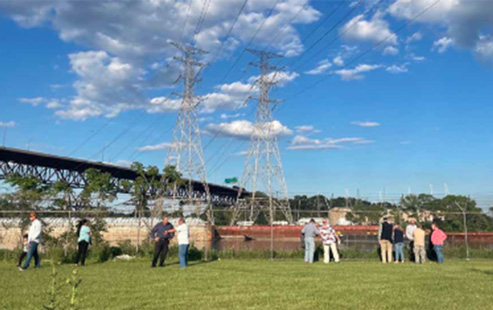 There are virtually no legal access points to the river in the Calumet region. By transforming the 100th Street site along the Calumet River (which runs from about 96th Street to 100th Street), UIC’s Great Cities Institute (GCI) aims to expand access to the river. In collaboration with Calumet Connect partners, NeighborSpace, the National Park Service, Blue Marble, Active Transportation Alliance, and the site’s private landowners (People’s Gas and NRG Energy), GCI is building on ideas from the Calumet River Communities Planning Framework and the Our Great Rivers vision to activate the site for community use.
The site was previously home to utility production and distribution operations and is still privately owned by People’s Gas and NRG Energy. GCI has hosted four activation events to get community input on future use of the site, with the aim to use it as a guide to develop and implement a plan for site activation which may include elements like a naturalized river edge, pedestrian trails, gardens, and public art installations.
Through strategic partnerships and community-driven engagement, the projects collaborating with Calumet Connect partnership seek to address long-standing environmental injustices and shape a more equitable and sustainable future for the area. These projects pave the way for a more vibrant Calumet region that supports an active industrial and commercial corridor, while also protecting environmental health, and expanding access to the river for communities to enjoy.
Looking for more information about past Our Great Rivers grantees?
Find the summary pages here: